|
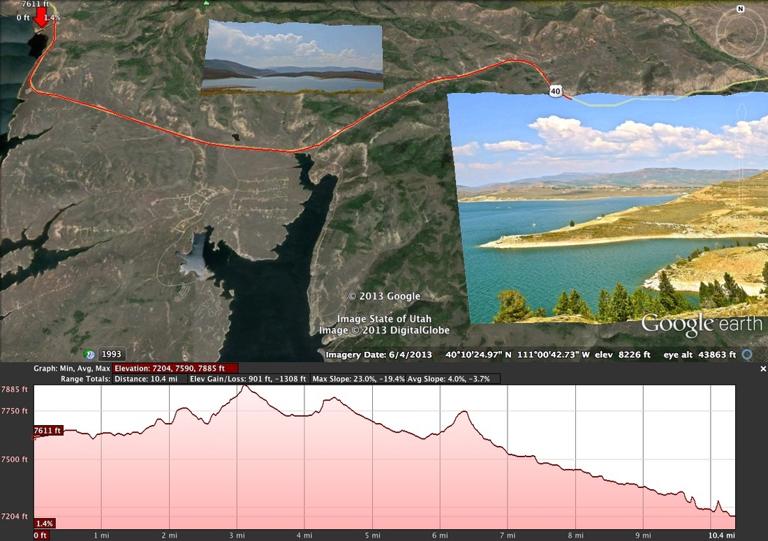
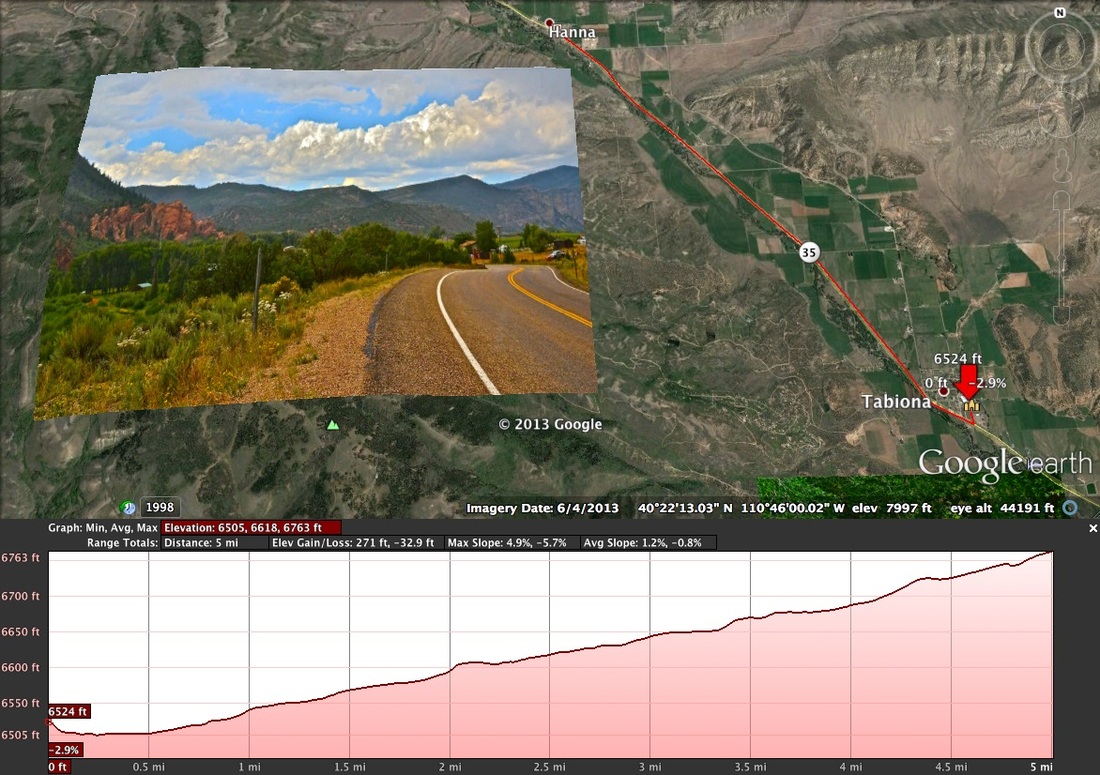
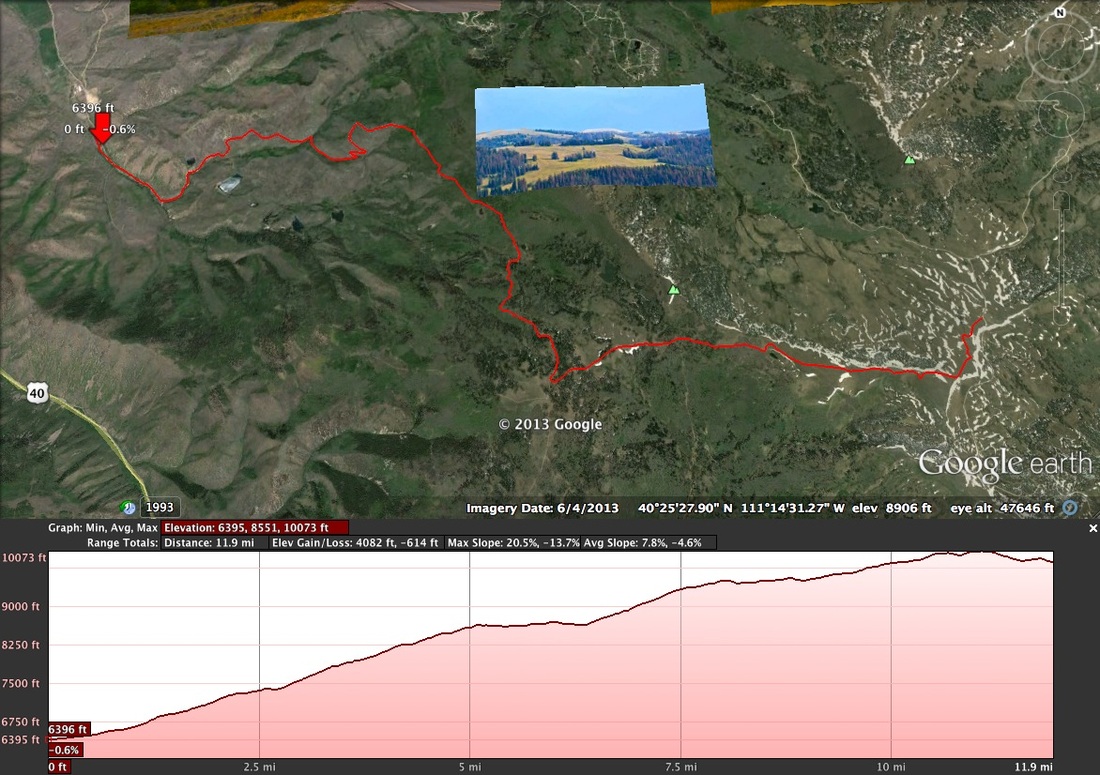
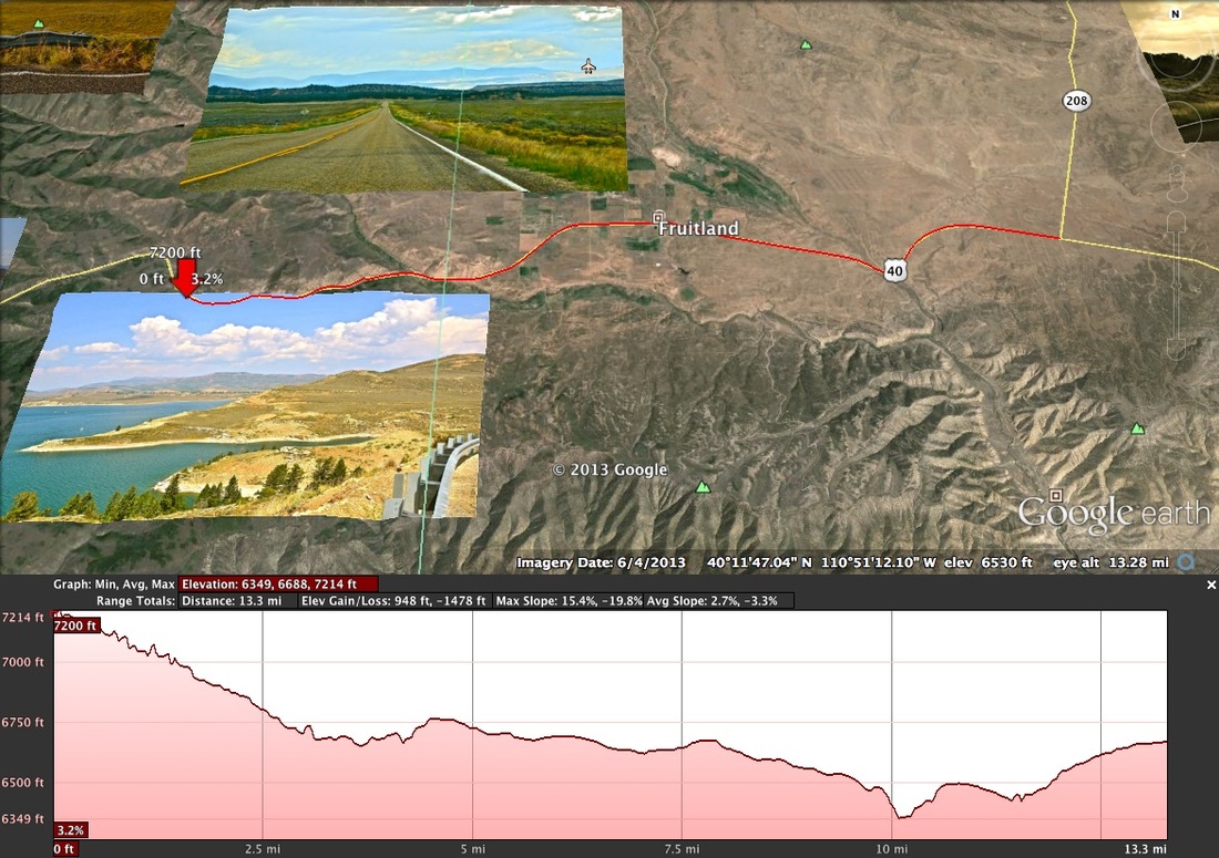
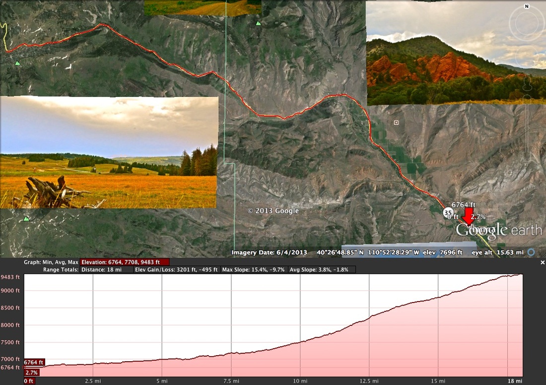
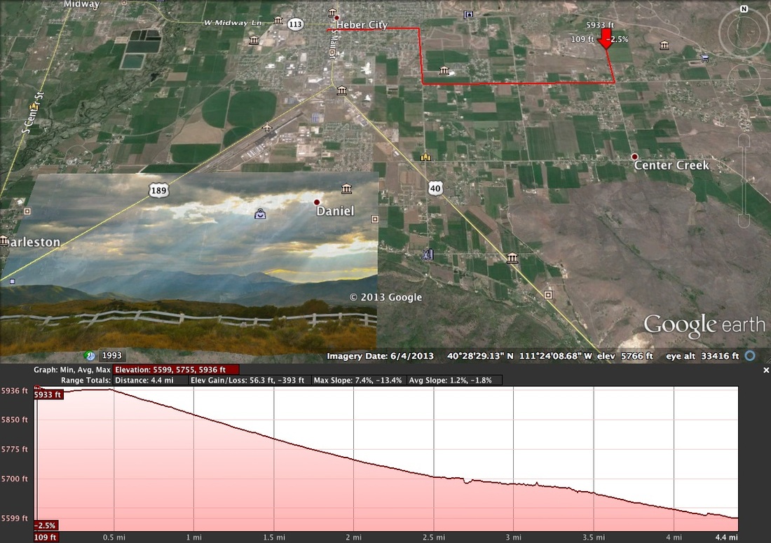
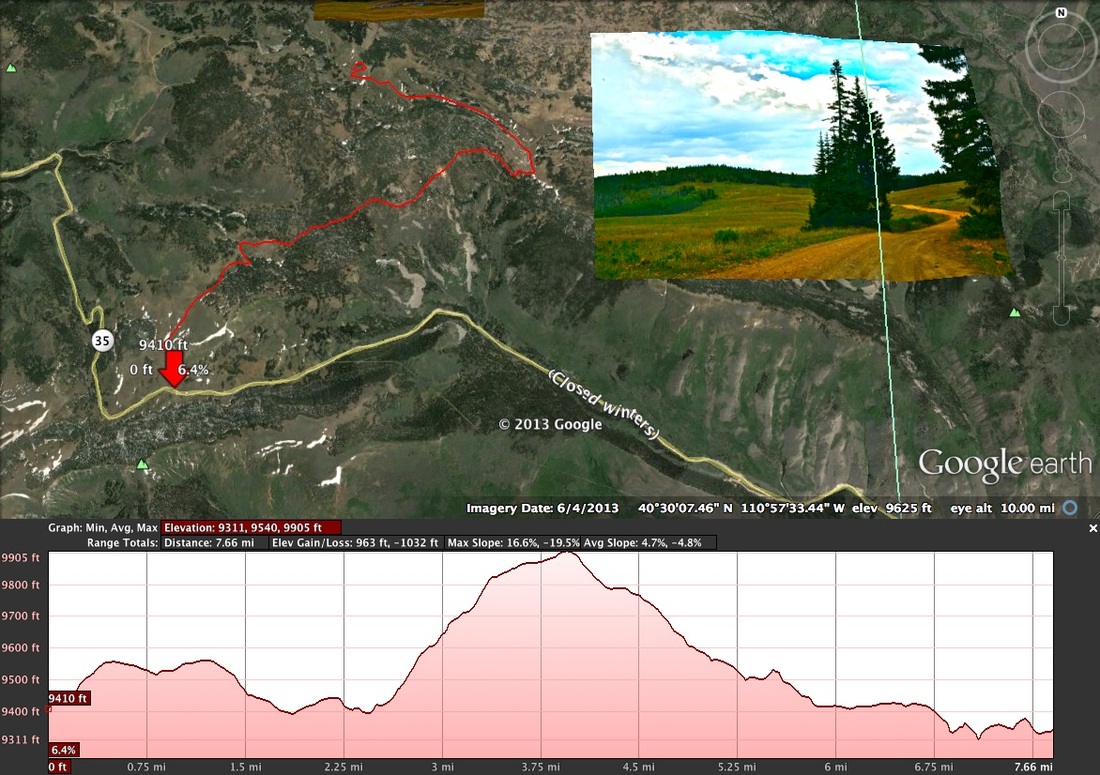
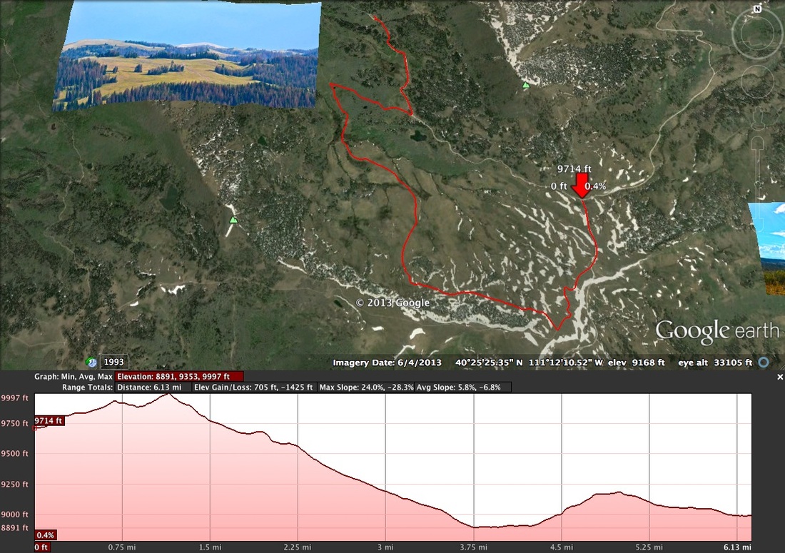
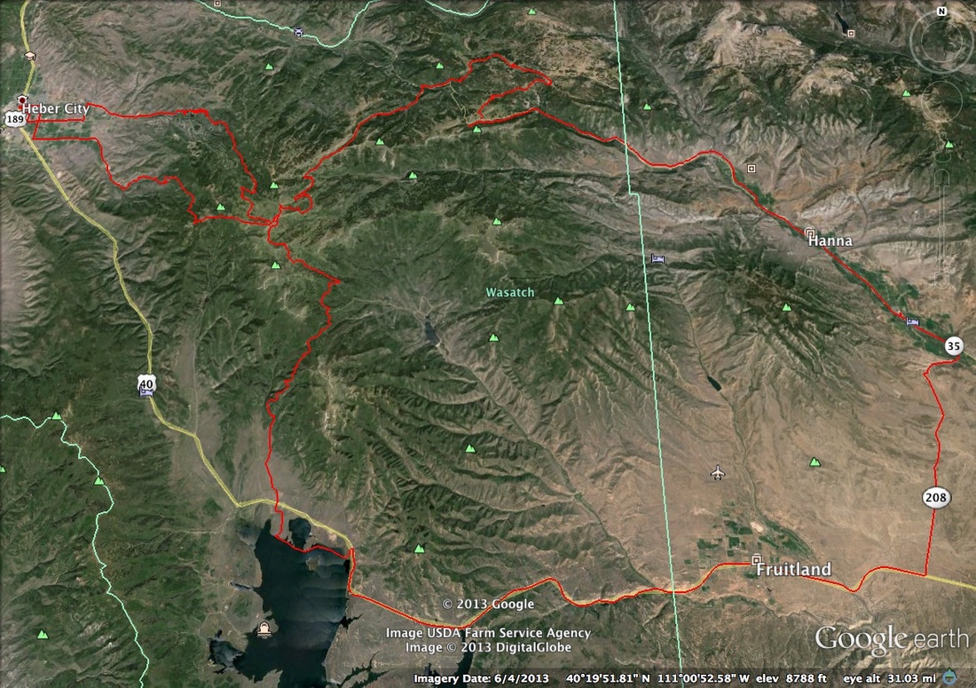
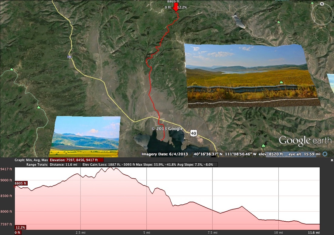
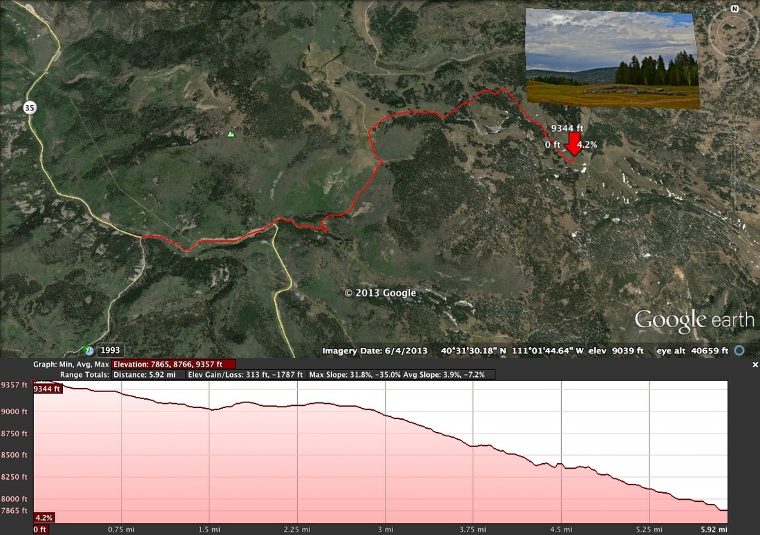
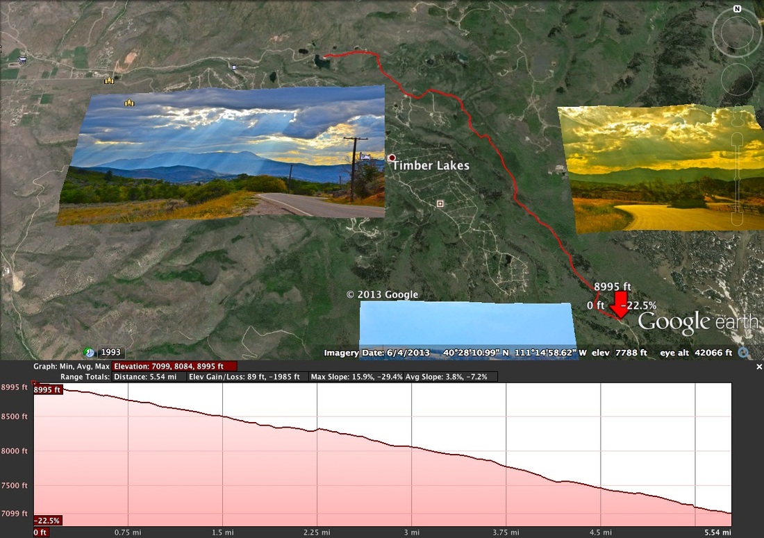
Leg Maps
Click on each image below to enlarge image for better details and to review the individual maps.
We have also posted each of the Leg Maps on our Uinta Mountain Adventure Relay (UMAR) Facebook (https://www.facebook.com/pages/Uinta-Mountain-Adventure-Relay/240869282708735?ref=hl) and included highlights about each leg. Go to our facebook page so you can learn more about the all the great adventures along the course! While you are there, don’t forget to like us so you can get all the updates! Click the like button to go directly to our Facebook page. 
For a quick overview of the mileage see our Overview Mileage Chart for planning your team legs, mileage for each leg, net elevation and level of difficulty CLICK HERE.
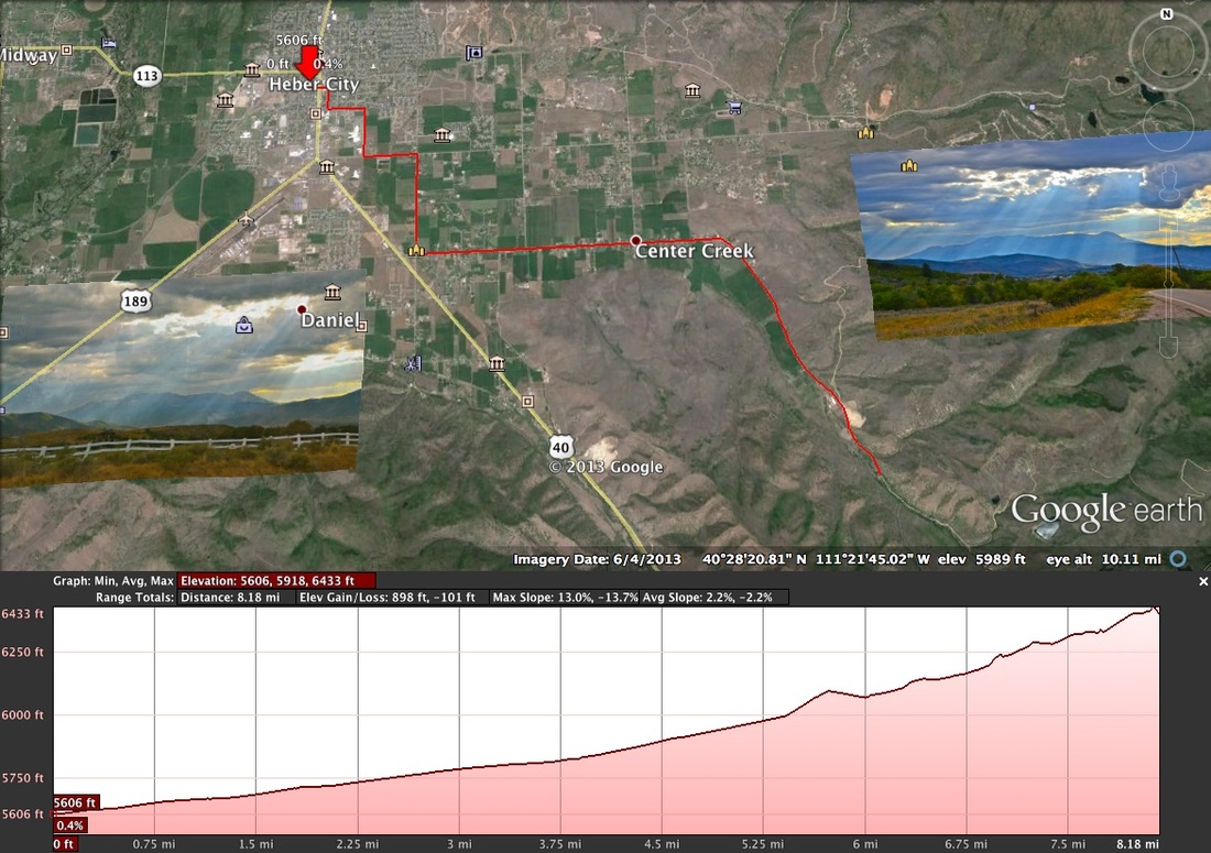
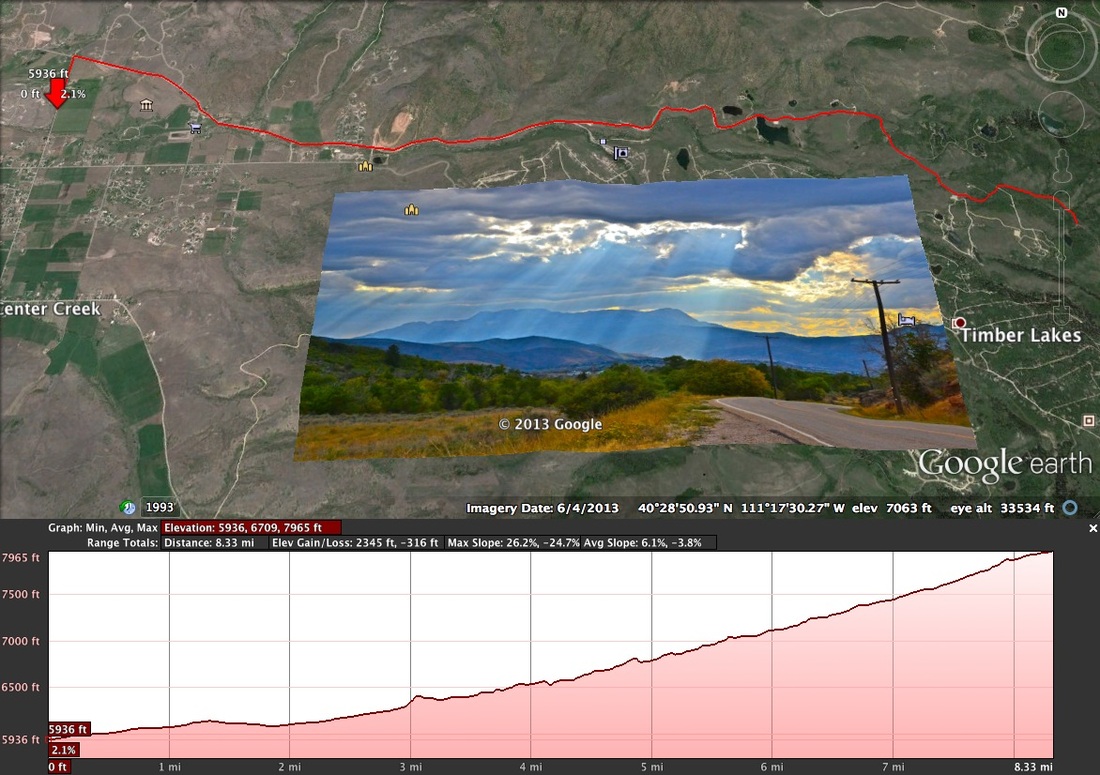
KING OF THE MOUNTAIN LEGS There will be three king of the mountain legs on three of the hardest and longest climbing legs in each of the three categories of running, mountain biking and road biking. Each of these legs will be tracked on the Strava cycling and running phone app you will need to carry one on your climb. To complete the King of the Mountain Leg you must track your progress on the app and at the completion of the relay we will then see who the King of the Mountain winner is in each category, prizes will be awarded. The three legs are Leg 2 12.6 mile Mountain Biking up center creek. Leg 11 5.3 mile run big uphill start. Leg 17 18 mile road bike to the top of Wolf Creek Pass. Let’s find out who has what it takes to get to the top.
|
|
|